contacts
+7 (727) 380-30-54
+7 (700) 222-49-86
+7 (707) 834-48-49
Email
ionos@ionos.kz
Adress
050020, Republic of Kazakhstan, Almaty, Kamenskoye Plateau, Gardening Association "Ionosfera" 117

Technical Equipment

The operating principle of ground-penetrating radar (GPR) is based on emitting ultra-wideband nanosecond pulses, receiving signals reflected from the boundaries between media, stroboscopic processing of the received signals, and subsequently measuring the time intervals between the reflected pulses.
Georadar OKO-2
UAV Delair UX 11
Spectra Geospatial SP90m GNSS Receiver
drone Matrice 350 RTK
ТCA 2003 Electronic tacheometer
Lidar DJI Zenmuse L 1
Leica DNA03 Digital Level
Georadar OKO-2
The operating principle of ground-penetrating radar (GPR) is based on emitting ultra-wideband nanosecond pulses, receiving signals reflected from the boundaries between media, stroboscopic processing of the received signals, and subsequently measuring the time intervals between the reflected pulses.

As the ground-penetrating radar moves across the surface of the investigated medium, a set of signals (radargram or profile) is displayed on the monitor screen. From this data, one can determine the thickness of the underlying (bedrock) layers, the location, depth, and extent of subsurface objects.
UAV Delair UX 11
UAV Capabilities (Unmanned Aerial Vehicle Capabilities)

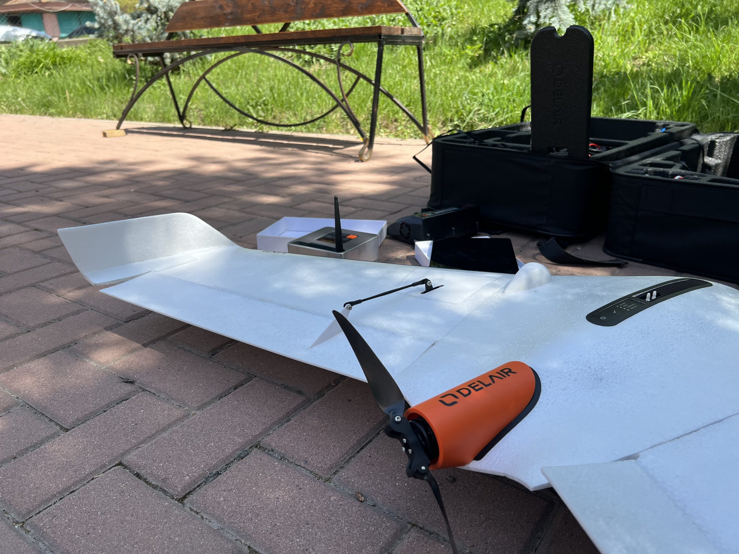
Aerial image resolution up to 2.0 cm/pixel;
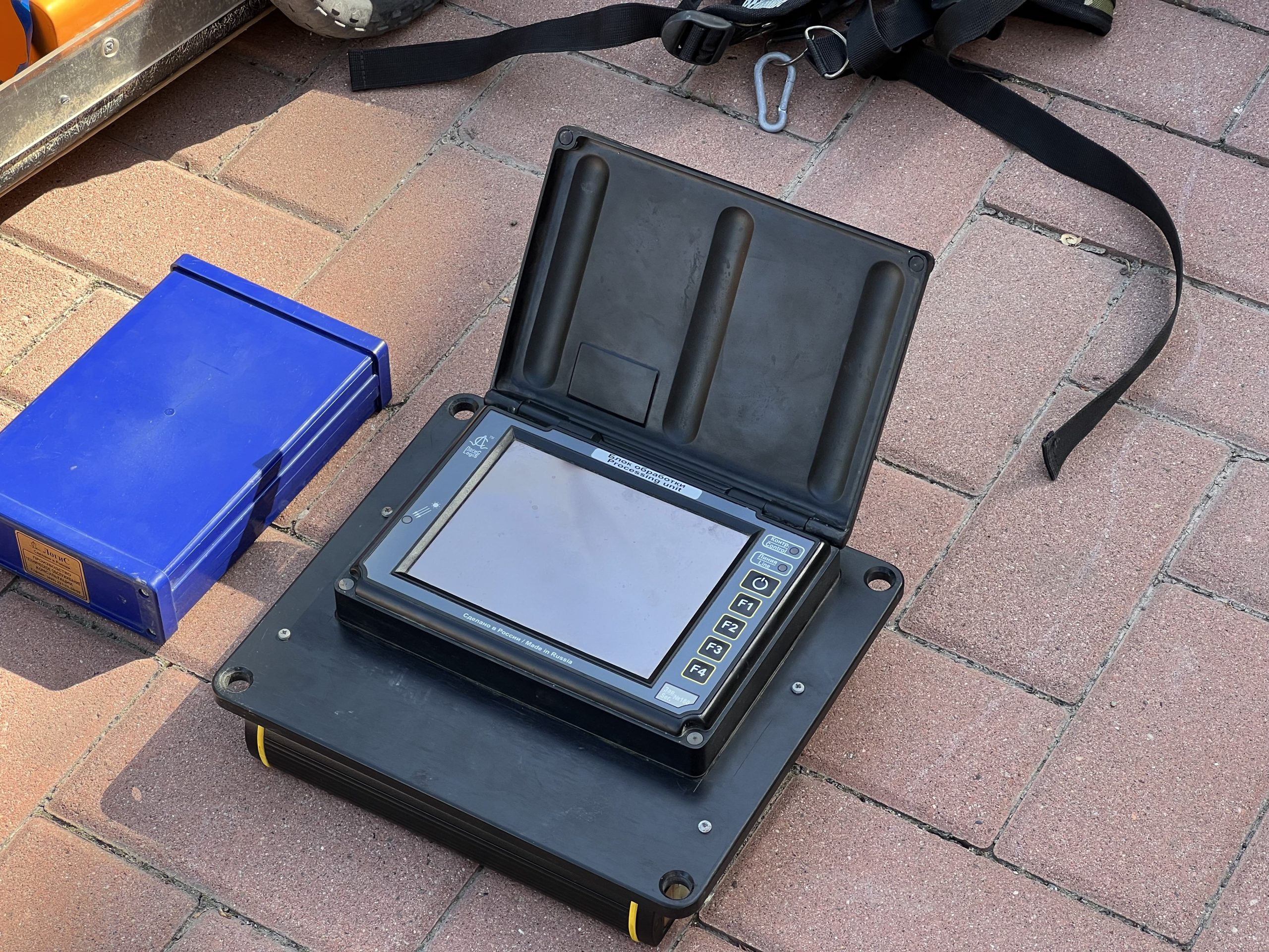
Each image is accompanied by telemetry data: coordinates of the central point, altitude, shooting angles, heading, roll, speed, and pitch.
Capability to launch from small, unprepared sites, including mountainous and foothill areas;
Capability for automatic and semi-automatic takeoff, flight, and landing;
In the event of signal loss, the automatic return system ensures that the UAV returns to the takeoff point.
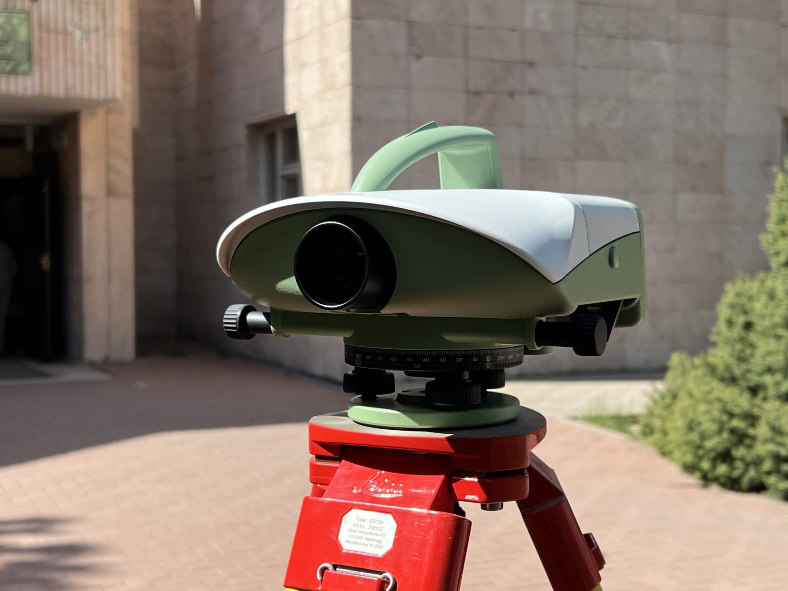
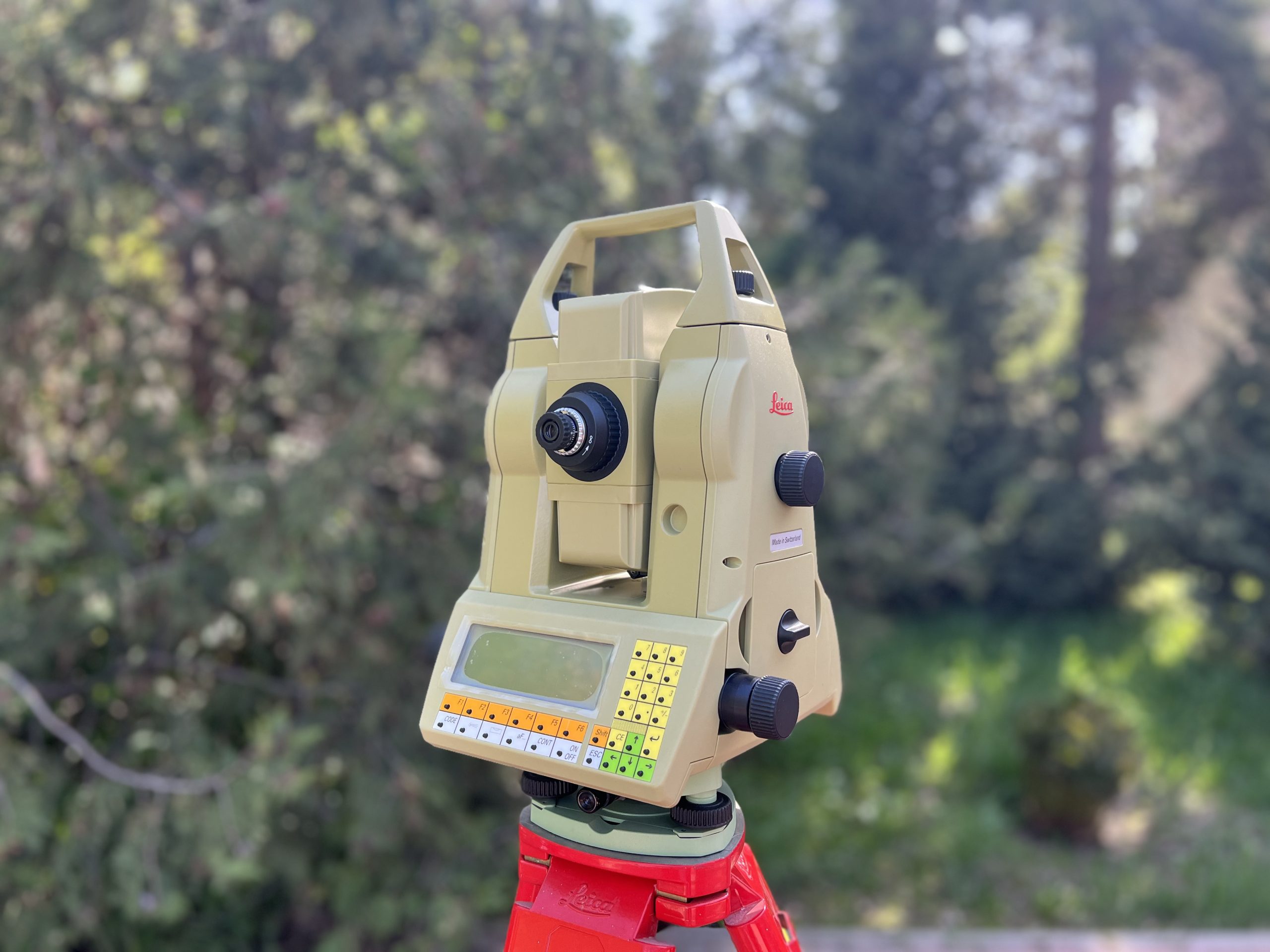
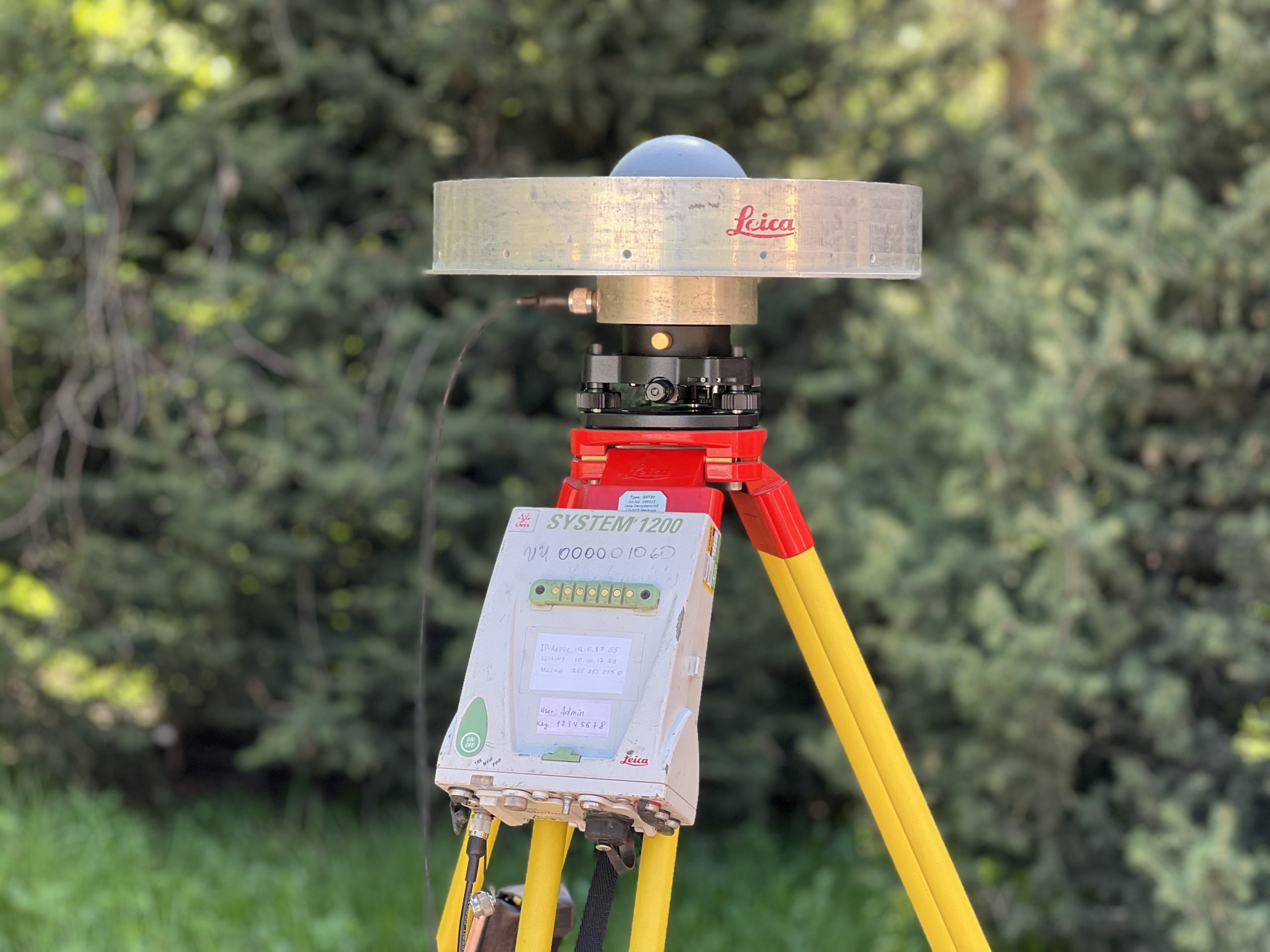
Ground support for large-scale aerial photography is carried out using a ground-based GNSS system with geodetic-level accuracy.
Option for additional installation of a multispectral camera
ТCA 2003 Electronic tacheometer
Spectra Precision SP90m GNSS receivers feature 480 communication channels and are compatible with satellite systems such as GPS, GLONASS, Galileo, BeiDou, QZSS, IRNSS, and SBAS. The modular design enables the receiver to be used as a field base station, a continuously operating reference station (CORS), an RTK or RTX rover, or integrated into vehicle onboard networks, among other applications.

Connecting two GNSS antennas allows the use of Spectra Precision SP90m geodetic receivers on vehicles. This enables precise determination of the vehicle’s direction of movement and speed.
DNA 03 Digital Level
The DNA03 electronic level by Leica is a precise and reliable instrument designed for the most demanding tasks that require high measurement accuracy.
The operation of the Leica DNA03 level is based on comparing the obtained measurement results with the reference data of the invar staff stored in the device’s memory. The automatic compensator improves the accuracy and reliability of measurements. A wide range of built-in programs enables the user to perform various tasks, such as reading the staff and determining distances, tying and untying traverse lines, automatically calculating height differences, and more. The Leica DNA03 digital level can operate both in electronic mode with invar staffs and in optical mode with standard leveling rods.
Spectra Geospatial SP90m GNSS Receiver
Spectra Precision SP90m GNSS receivers feature 480 communication channels and are compatible with satellite systems such as GPS, GLONASS, Galileo, BeiDou, QZSS, IRNSS, and SBAS. The modular design enables the receiver to be used as a field base station, a continuously operating reference station (CORS), an RTK or RTX rover, or integrated into onboard vehicle networks, among other applications.
Connecting two GNSS antennas allows the use of Spectra Precision SP90m geodetic receivers on vehicles. This enables precise determination of the vehicle’s direction of movement and speed.
The built-in GSM modem of the Spectra Precision SP90m GNSS receiver allows reception of corrections via cellular communication channels. Additionally, using the modem, you can transmit vehicle position and speed data to a selected server for transport monitoring or tracking valuable cargo.
drone Matrice 350 RTK
The Matrice 350 RTK is a professional quadcopter by DJI, representing an advanced model in the Matrice series. It is designed to perform complex tasks in mapping, inspection, construction, agriculture, and other fields that demand high precision and reliability.
RTK (Real-Time Kinematic) is a technology that enables high-precision positioning (up to 1 cm) through the use of an external base station or correction network. This makes the Matrice 350 RTK ideal for mapping missions and other tasks that require highly accurate georeferenced data.
Lidar DJI Zenmuse L 1
The DJI Zenmuse L1 is a professional LiDAR sensor compatible with DJI's Matrice 300 RTK and Matrice 350 RTK drones. The Zenmuse L1 is designed for high-precision surveying using laser scanning to create 3D maps, models, and mapping data.

The system provides positioning accuracy of up to 2 cm using RTK (Real-Time Kinematic), allowing for the acquisition of highly accurate information about the Earth's surface. Measurement accuracy depends on the use of RTK and may vary depending on conditions, but with proper configuration, it delivers high-quality results.

Contacts

+7 (727) 380-30-54

+7 (700) 222-49-86

+7 (707) 834-48-49

ionos@ionos.kz

050020, Republic of Kazakhstan, Almaty, Kamenskoye Plateau, Gardening Association “Ionosfera” 117

Subscribe and stay informed of events